4 Sep 2019 7:37 pm

That's the point on Sept 1st all maps pointed to the fact that dorien stood a good chance of crossing Florida and entering the gulf.Misty » 04 Sep 2019 7:17 pm » wrote: I was not talking about the spaghetti model from August 28th.
And BTW have you seen what it says under that map?
The whole thing causes me nothing but confusion.
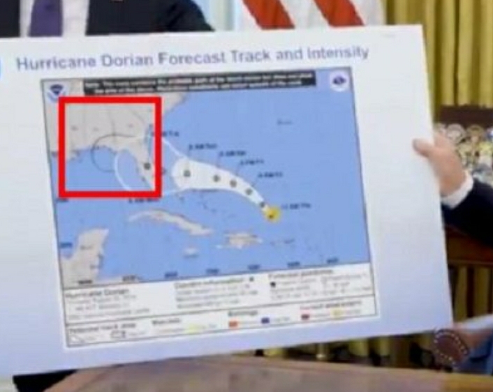
I am talking about the map that the POTUS held up TODAY.
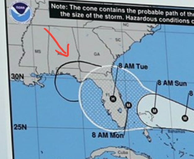
In order to make it look like Trump was right when he Tweeted on Sept. 1st that Alabama would take a hit by Dorian, someone drew a line in black sharpie on this map from August 29th to make it look like the cone of the storm included Alabama.
NOAA does not update their maps in black sharpie.
But the POTUS is famous for using a black sharpie.
And apparently alter weather maps too.