4 Sep 2019 8:20 pm

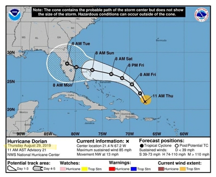
I see someone making a point .. defending themselves against the onslaught of stupid that ecompesses America. I believe the image was used to illustrate the point of his earlier tweet.Misty » 04 Sep 2019 8:12 pm » wrote: The map he held up today (minus the sharpie mark that extended the cone of the storm to include Alabama) was from August 29th.
Here is the NOAA map from August 29th.
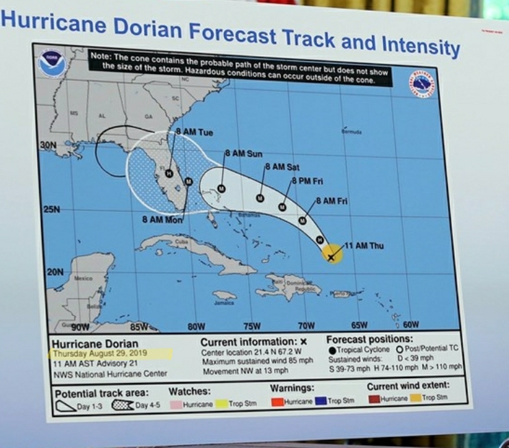
And here is that same exact map when Trump held it up today in the Oval Office.
Notice anything different?
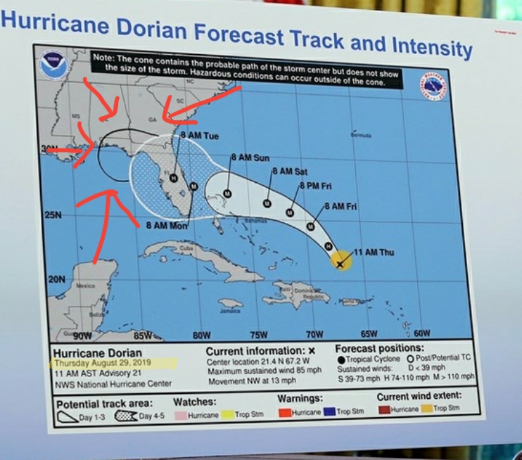
Here's a hint.
Do you actually think NOAA did that?

I don't know why you find it so hard to believe that a man who lies 20 times a day would not try to pull off a stunt like this.