Liberal Forum
Archive
‹
The Water Cooler Chat Room
‹
Trump may have broken federal law by altering Hurricane Dorian's path on a map.

4 Sep 2019 5:49 pm
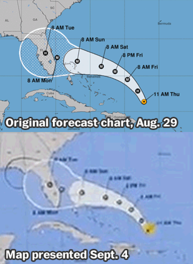
So the hurricane center draws on their maps by hand in black sharpies now?Lucifershammer » 04 Sep 2019 4:43 pm » wrote:It wasn't altered you posted the original track put out by the National hurricane center. It's changed 6 times since then.

They show the 'cone' in white.
They don't extend it with a black sharpie.
Look at this GIF again.
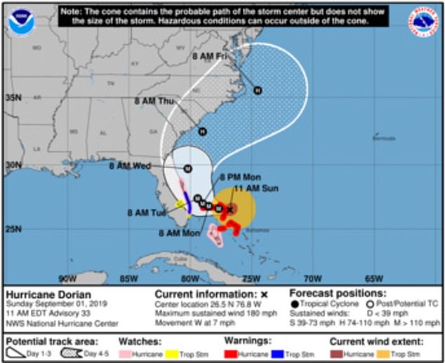
This is the predicted path of the storm on the day he Tweeted that Alabama would take a hit (Sept. 1st.)
The 'cone' is no where near Alabama.