Liberal Forum
Archive
‹
The Water Cooler Chat Room
‹
Trump may have broken federal law by altering Hurricane Dorian's path on a map.

4 Sep 2019 8:12 pm
The map he held up today (minus the sharpie mark that extended the cone of the storm to include Alabama) was from August 29th.Lucifershammer » 04 Sep 2019 7:37 pm » wrote:That's the point on Sept 1st all maps pointed to the fact that dorien stood a good chance of crossing Florida and entering the gulf.Misty » 04 Sep 2019 7:17 pm » wrote:I was not talking about the spaghetti model from August 28th.
I am talking about the map that the POTUS held up TODAY.
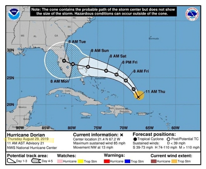
Here is the NOAA map from August 29th.
And here is that same exact map when Trump held it up today in the Oval Office.
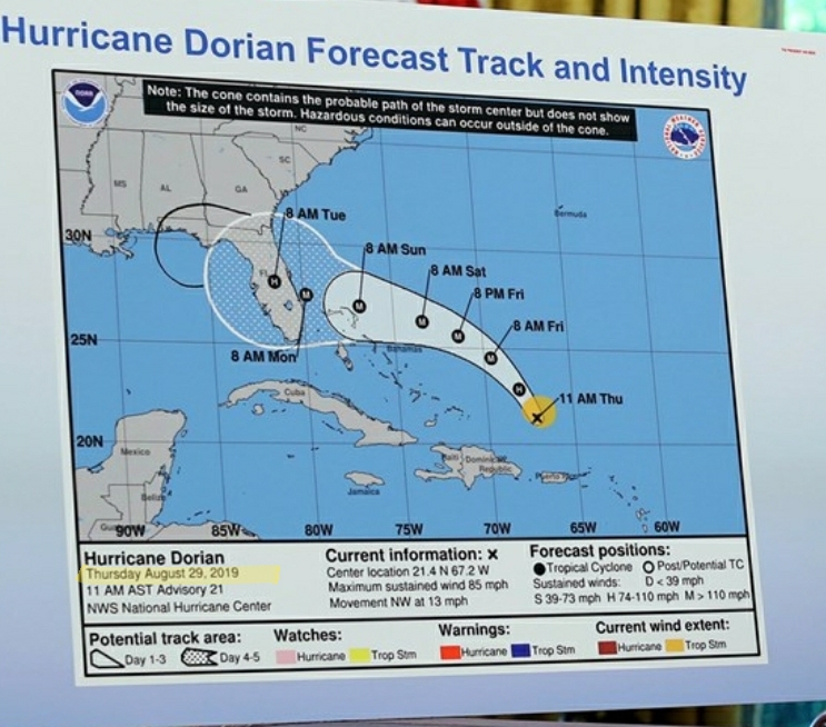
Notice anything different?
Here's a hint.
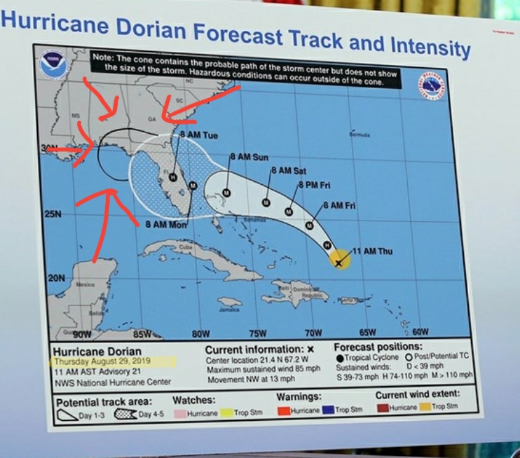
Do you actually think NOAA did that?

I don't know why you find it so hard to believe that a man who lies 20 times a day would not try to pull off a stunt like this.